Creek Daylighting and Salt Marsh Restoration Proposals
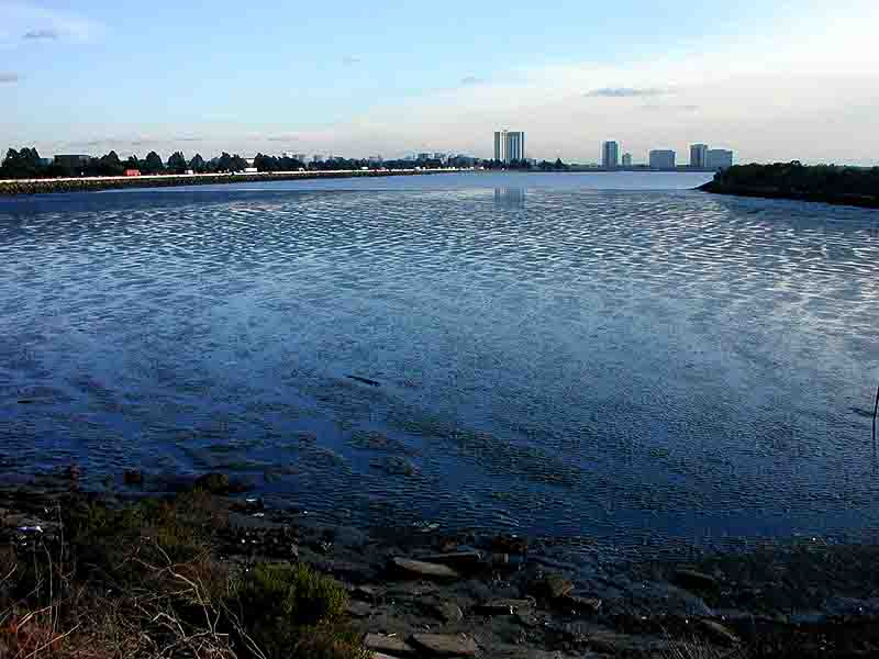
As early as 1984, there has been interest in the idea of re-routing the
Strawberry Creek outflow into the cove between the Brickyard Peninsula and
Frontage Road. These early proposals were motivated in part by the desire to develop
a recreational Berkeley Beach at the current outflow location, and in part by
the desire to enhance the development of a salt marsh and take advantage of the
natural cleansing, filtering, and ecosystem support capabilities of a marsh.
The plan for the Eastshore State Park is likely to involve at least a small amount of creek daylighting. City of Berkeley staff have also shown increased interest in using wetlands to improve the water quality at creek outflows.
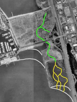
Here are a couple of sketches showing possible reconfiguration of creek
outflows. Schoolhouse Creek (which now empties into the south-east corner of the North Sailing Basin) and Strawberry Creek (which now empties into the South Sailing Basin just west of Seabreeze Market) are affected. The light gray lines on the maps indicate approximate mean low water (MLW) and mean lower low water (MLLW) limits of exposed mud.
Note that in these proposals, none of the Meadow is used as water quality
wetland, except to the extent that water quality may improve as it flows along
the open creek bed. This creek bed can be configured so as not to affect other
elements of the Meadow's drainage, and would leave most of the seasonal
ponds as they are now. Some capping would presumably be required to create a
stable and predictable creek configuration - although it might be
possible to route the creek around toxic-bearing areas and minimize
capping.
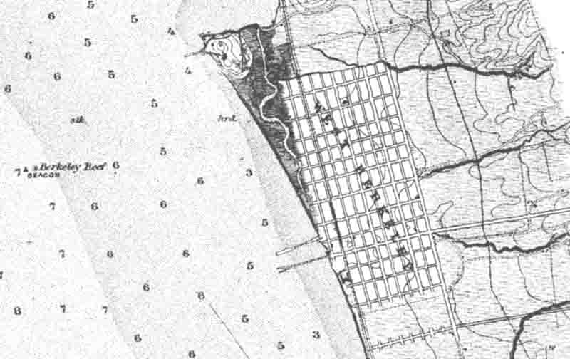
Creek daylighting and salt marsh restoration would also represent a return to the original hydrology of the Berkeley shoreline. The chart reproduced below is from 1883, and shows the extensive salt marsh at creek outflows.
The sketch to the right shows a fairly extensive daylighting proposal, involving about 3/4 mile of open creek in upland areas, and probably an even greater length of watercourses in the salt marsh.
The area between the Brickyard Peninsula and Frontage Road, currently a
tidal flat, is the most likely candidate for transition to a viable salt
marsh because it has both the highest bottom elevation and the best
protection from wave action. It appears to be a lot further along in the
slow process of natural evolution to a salt marsh than any of the other
subtidal areas in the North or South Sailing Basins. Also, the high ground
of the Brickyard Peninsula itself (originally built to be a railroad
spur) might offer a good place from which to view wildlife in the marsh, while keeping humans at a safe distance.
Depending on funding and technical feasibility, the transition to salt
marsh could be accelerated by adding clean dredge spoils, or it could be
left to develop on its own over the next several decades.
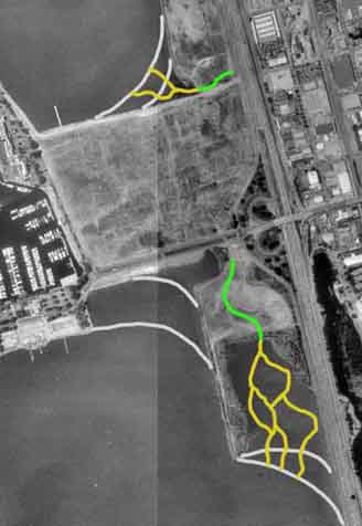
The next sketch shows a lower-impact alternative, involving no use
of the Meadow at all. Strawberry and Schoolhouse Creeks remain
isolated. The prospects for creating a viable salt marsh at the Schoolhouse
outflow might be more limited, but with some intervention it would
probably be possible to accelerate the process somewhat.
Another undetermined technical issue is whether daylighted portions of the
creeks would be salt or fresh. In order to avoid high tide salt water
incursion, the water level in a fresh water creek would have to be about eight feet
above MLLW or five feet above MSL. This is probably not feasible due to
limited pressure head capabiity of the existing upstream culverts, but the
freshwater creek habitat might offer much greater diversity in the context of a shoreline park, and some effort should be made to see if this is a possibility.
A more detailed site plan
Tje creek and marsh restoration plan by Nabil Al-Hadithy, PhD
CESP's reaction to the plan, and a continuing dialogue.
|