|
|
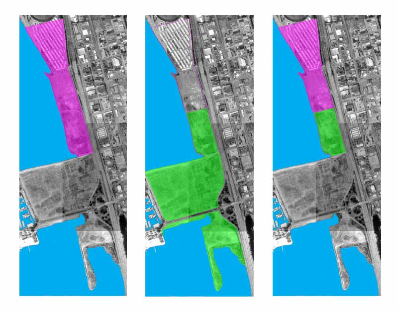
These maps show the relative sizes of the areas at issue.
On the map on the left, the areas shaded in magenta are the "Measure Q Lands" on which up to 565,000 square feet of development were allowed under Measure Q. On the map in the middle, the areas shaded in green are the Berkeley lands acquired by the State for the Eastshore State Park. The map on the right shows the relative sizes of developable lands acquired for the park and the developable lands not acquired. It is apparent that only about one-third of the developable lands were acquired. On this basis, remaining development could be up to 377,000 square feet. However, the City Attorney's analysis is more detailed, examining specific development projects. The City Attorney concludes that only 225,000 square feet, or about 40% of the original allowed maximum, is the new development ceiling. |