|
|
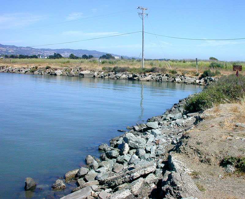
The Southwest Corner of the North Sailing Basin, where the State's planning consultants propose locating a dock for non-motorized and hand-launched small craft. (See a similar view at low tide.) Although details are not shown in the concept plan, the land area occupied by the facility could be well under an acre (compared to a total of 73 acres for the entire Meadow). CESP, Audubon, and Sierra Club oppose facilities for small craft at this location on the grounds that they would interfere with bird nesting areas, especially northern harrier and white-tailed kite. But the birds in question roost in the willow trees seen in the background, closer to existing roads than to the proposed facility. Also, much of the land in question is the paved Virginia Street extension and rip-rap shore protection. Loss of habitat would not be nearly as serious as has been represented. There is, however, an interesting seasonal marsh in the NW corner of the Meadow, usually fresh but inundated with salt water when unusually high tides coincide with storm surges. As long as the boating facility is small, and if most parking is limited to the existing gravel parking area along Marina Blvd (and outside the Eastshore State Park boundary), then it will be easy to locate the facility so that this marsh area remains undisturbed. CESP, Audubon, and Sierra Club members have fought the good fight for decades to keep the Meadow free of shopping centers and office towers, and they have earned our gratitude and respect. However, this long history of opposition makes it politically untenable for them to acknowledge that there might in fact be some appropriate uses of small portions of the Meadow other than open space and habitat preservation. It would be a great loss if the recreational potential of the waterfront goes unrealised because of political constraints. |
previous photo - - - - - - - - - - - - next photo