Just for comparison, you can look at a table of rainfall totals for a few previous seasons:
1998/1999 season
Highlights of the Current Season - July 1, 2008 - June 30, 2009
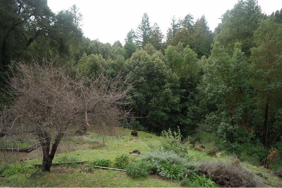
After the fire in June, there was plenty of activity on the mountain. Lot's of tree trimming, brush clearing, and generally more awareness of the very real fire danger that exists living in a dry woodland. The summer was fairly typical, a couple of hot spells, and no additional drama to report.
After a warm September, October brought in welcome moisture on the 4th, reducing the fire danger. Overall, a very dry October, but more welcome rains finally arrived on Halloween. And on November 1st, the skies really opened up with nearly 6 inches overnight. Winter had begun with a bang. But despite the seasonal temperatures, it remains drier than normal.
Winter returned on December 12, with much colder temperatures and welcome moisture. Snow, sleet and thunder was on the mountain the night of the 15/16th, followed by frigid temperatures on the 20's. More rain moved in on the 19th and the 22nd. Christmas day was cold, wet and windy. Light rain continued into early January, but so far, significant amounts are not here yet. Mid-February brought cold temperatures and steady rain to the coastal mountains. And we finally had the first significant rain on the 16th, with almost 6 inches falling in that one day. February turned out to be a near-normal month for rainfall, and March is off to a good start as well. Spring began warm and pleasant, and then the night of the 22nd brought rain, hail cold wind and light snow to the mountain. Spring really sprung in early April, and welcome showers arrived on the 7th, adding to the greenery.
Season total (to 8:00 AM, April 10, 2009): 47.50 Inches
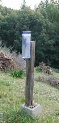
The Rain Gauge
I keep these unofficial
readings as a personal interest. I have seen our reading exceed other
gauges that are located at lower elevations nearby, so I figured this
might be of interest to others. For rainfall amounts up to 11 inches, we
now use a NWS certified rain gauge. In the past, when amounts overnight
were higher than 5 inches, I had to use a vertical wall bucket at least
a few times every winter. The new gauge should be able to handle all
but the most extreme rainfall.
In years past, I was distrustful about the
unusually high rainfall readings, changing gauges and trying various methods and
locations to improve accuracy. However, after much experimentation, and
then checking with our neighbors, I think we are simply in a
micro-climate with more rain than other places. This is the Santa Cruz
Mountains, after all. As the Weather Service says, we are in an
"Orographically Favored Location." I think that means we get soggy when
others simply get wet.
During the 2005-2006
season, I added an electronic gauge. It used to sit next to the "analog"
gauge. After a number of seasons, I gave up trying to use it. It easily clogged, and required much more maintenance that the "analog" gauge. The old fashioned method was just more reliable.
There is one official
California Department of Water Resources weather monitoring site
located nearby, at a slightly higher elevation. They match my readings
here at 2200' fairly well. You can compare for yourself, at Ben Lomond Mountain
(2630', three miles up the road from here). Their measured rainfall
tends to be slightly less, but the temperature tracks pretty close to
our location.
There are also a couple of
other nearby, lower elevation locations where rainfall is measured. One
long-time measurement created by Ted Cantrall is here, and another very informative site, run by the folks at Anometal.com can be found here.
As with most places in this
region, we are in a "micro-climate". Ours happens to be very wet during
the rainy season, due to our location, elevation and southern exposure
to incoming storms. During large storms, average winds of 40 to 60 mph
are typical here. In December of 1995, we had winds approaching 100
mph, and during February, 1998, peak winds approached 85 mph. The
season is officially measured from July 1 to June 30, although rain
usually only falls between September and May, a typical "dry and wet"
seasonal pattern. Snow
does fall here, but it is usually not more than a few inches at a time.
The temperature range is not too extreme, and only falls below 25
degrees a few weeks every winter. 1991 was the exception, with lows in
the teens for over a week. The winters of 1973, 1975, 1982, 1986, 1995,
1998, 2001, 2002 and 2006 brought significant snowfall.
If you found your way to this page via a search engine, please refresh or reload the page for the latest updates.
You can return to the Home page here.